
 Bernd Dittrich / Unsplash
Meilleure période
Septembre à novembre pour le fynbos en fleur et les baleines franches australes dans False Bay ; d'octobre à mars, les portes ont leurs horaires les plus longs. Le vent du sud-est culmine de novembre à février — partez tôt dans la journée, et attendez-vous à du vent quelle que soit la période.
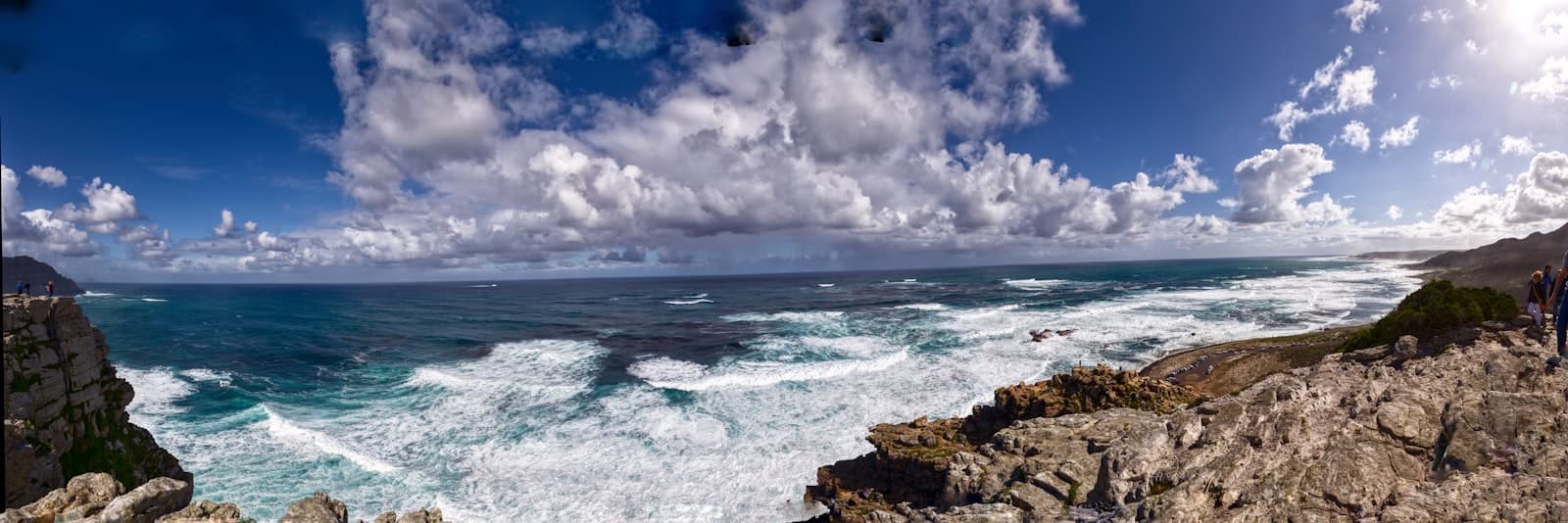
À l'extrémité sud de la péninsule du Cap, la terre se resserre en une échine de falaises de grès et s'arrête, tout simplement. Cape Point en est la proue orientale, une muraille de roche de 200 mètres au-dessus de la houle ; le cap de Bonne-Espérance est le promontoire plus bas et plus sauvage situé à environ 2 km à l'ouest-sud-ouest, que l'on rejoint par une courte route menant à son propre parking ou par une marche balisée en haut de falaise d'environ 3.5 km aller-retour. Ce qui vous y attend est un panneau de bois patiné qui a probablement été photographié plus que tout autre objet en Afrique du Sud. Sa formulation est soigneusement pesée, et exacte : SANParks décrit l'endroit comme le point le plus au sud-ouest du continent africain. Ce n'est pas la pointe sud. Ce titre revient au cap Agulhas, à quelque 150 km à l'est-sud-est — un autre promontoire, et une tout autre histoire.
Les Portugais arrivèrent en 1488. Bartolomeu Dias, envoyé vers le sud par le roi Jean II pour trouver le bout de l'Afrique, dépassa le cap dans une tempête sans le voir et n'aperçut le promontoire qu'au retour, en mai. La version bien rangée — celle que raconte SANParks lui-même, et celle que vous entendrez dans tous les bus touristiques — veut que Dias l'ait baptisé cap des Tempêtes et que le roi Jean II l'ait rebaptisé cap de Bonne-Espérance pour la route maritime vers les Indes qu'il venait d'ouvrir. Ce récit vient du chroniqueur du XVIe siècle João de Barros ; Britannica relève une source contemporaine concurrente attribuant le nom porteur d'espoir à Dias lui-même, et juge cette version probable. Quoi qu'il en soit, le changement de nom fonctionna. Quatre-vingt-douze ans plus tard, le récit de la circumnavigation de Francis Drake le qualifiait de « plus beau cap que nous ayons vu sur toute la circonférence de la terre », et le Cap exploite la formule depuis lors. Deux croix de pierre sur les crêtes au-dessus — la croix de Dias et la croix de da Gama, érigées par le gouvernement portugais — servent encore de balises de navigation en activité : alignez-les et elles pointent vers Whittle Rock, un écueil immergé au large dans False Bay.
Le premier phare de Cape Point fut bâti au sommet en 1859 et allumé en 1860, et ce fut une erreur pleine de bonnes intentions. À 238 m au-dessus de la mer, il se dressait en plein dans les nuages qui déferlent sur la pointe, et le concessionnaire qui gère le site estime que les nuages bas l'aveuglaient jusqu'à 900 heures par an. Les navires qui ne voyaient pas le feu continuaient de trouver les rochers. Dans la nuit du 18 avril 1911, le paquebot portugais Lusitania heurta Bellows Rock au sud de la pointe dans exactement ces conditions, et le débat fut clos. Un remplaçant fut mis en chantier en 1913 sur Dias Point, bien plus bas, à 87 m, là où les nuages n'atteignent pas ; allumé pour la première fois le 11 mars 1919, c'est toujours le feu en service. La vieille tour, elle, fut laissée à son rôle de point de vue. Aujourd'hui, le funiculaire Flying Dutchman — 585 m de voie, deux cabines baptisées Nolloth et Thomas T. Tucker d'après des épaves de cette côte — hisse les visiteurs depuis 127 m jusqu'à une station juste en dessous en trois minutes environ, et c'est la voie accessible en fauteuil roulant vers le sommet. Les escaliers sont l'autre option.
Tout cela se trouve dans la section du cap de Bonne-Espérance du parc national de Table Mountain — la seule partie clôturée du parc, précisément à cause de ce qui y vit. SANParks invite les visiteurs à guetter élands, bubales roux, bonteboks et zèbres ; les autruches sont un spectacle courant sur les pâturages près de Buffels Bay et de Bordjiesrif. La végétation est le fynbos, et les chiffres qui la décrivent ne relèvent pas du marketing : l'UNESCO consigne que la Région florale du Cap abrite quelque 9,000 espèces végétales dont environ 69% ne poussent nulle part ailleurs, sur moins de 0.5% de la superficie de l'Afrique. Le parc national de Table Mountain est l'un des 13 ensembles d'aires protégées qui composent le site du patrimoine mondial des Aires protégées de la Région florale du Cap, inscrit en 2004 et étendu en 2015, et SANParks recense plus de 2,200 espèces végétales à l'intérieur des seules limites du parc. Les babouins chacma méritent un mot à part. SANParks les qualifie de « sacrés personnages » tout en avertissant qu'ils peuvent être dangereux — les troupes d'ici ont appris à associer l'humain à la nourriture. Ne mangez pas devant eux, n'ouvrez ni portière ni sac à dos à proximité, verrouillez votre véhicule, et si l'un d'eux vous fait face, restez immobile, évitez le contact visuel et reculez lentement. C'est le nourrissage qui a créé le problème.
Presque tout le monde arrive en s'attendant à voir l'Atlantique et l'océan Indien se rencontrer, et la vue ne l'offre pas tout à fait — ce qu'elle offre est sans doute mieux. SANParks le formule avec précision : les systèmes marins du Benguela, froid, et de l'Agulhas, chaud, se mélangent à la pointe, produisant ce qu'il appelle « une variété saisissante de vie marine ». Ce brassage est réel et on le voit souvent dans l'eau et chez les oiseaux, mais c'est une zone large et mouvante plutôt qu'une ligne, et la frontière officielle entre les deux océans est tracée ailleurs : l'Organisation hydrographique internationale fait descendre la limite occidentale de l'océan Indien le long du méridien 20° E jusqu'au cap Agulhas. Vous vous tenez donc dans le remous, pas sur la couture. Côté pratique : un droit de conservation SANParks s'applique à la porte de Cape Point — pour l'année tarifaire courant jusqu'au 31 octobre 2026, R110 pour les adultes sud-africains, R225 pour les ressortissants de la SADC et R515 pour les visiteurs internationaux, environ moitié prix pour les enfants — et la porte n'accepte que la carte. Les portes ouvrent de 06:00 à 18:00 d'octobre à mars et de 07:00 à 17:00 d'avril à septembre, et le funiculaire démarre plus tard que la porte : une arrivée matinale vous offre les falaises désertes plutôt que la file d'attente. Si vous voulez le Cap sans la foule, poussez jusqu'à Olifantsbos, où un sentier balisé des épaves d'environ 3 km passe devant les membrures du Liberty ship américain Thomas T Tucker, perdu sur Albatross Rock en 1942, et du caboteur néerlandais Nolloth, naufragé en 1965. Et ne vous baignez pas à Dias Beach : SANParks l'interdit à cause des courants d'arrachement, et aucune plage ici n'est surveillée.
Sources 70, 71, 73, 74, 76, 98, 151, 178, 179, 181, 243, 295, 298, 340, 341
Plus de Monuments & Villes
 Monuments & VillesGauteng
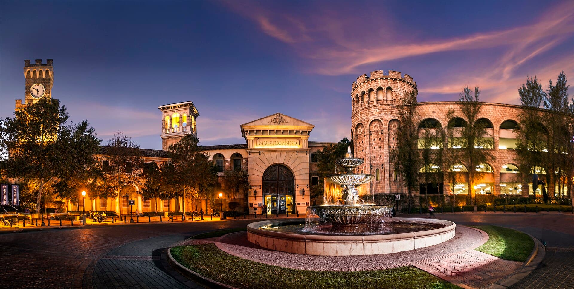
Montecasino
Un faux village toscan grandeur nature sous un ciel peint, dans le nord de Johannesburg — salle de casino, jardins d'oiseaux et ce que South African Tourism qualifie de plus grand théâtre du pays, le tout en intérieur.
Vérifié · 6 sources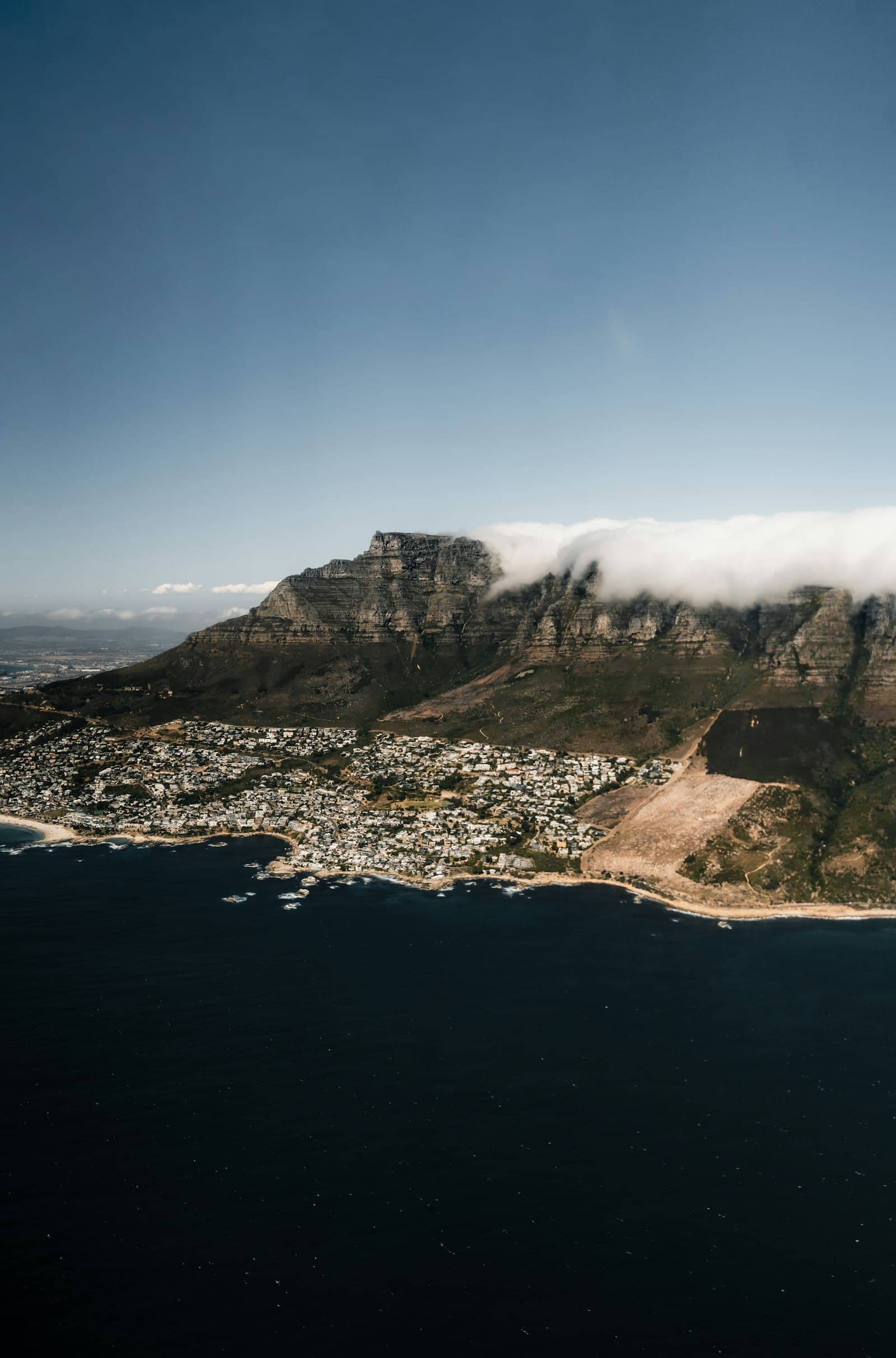 Monuments & VillesCap-Occidental
Table Mountain
L'icône au sommet plat du Cap — accessible par téléphérique ou par une randonnée dans la Platteklip Gorge.
Vérifié · 2 sources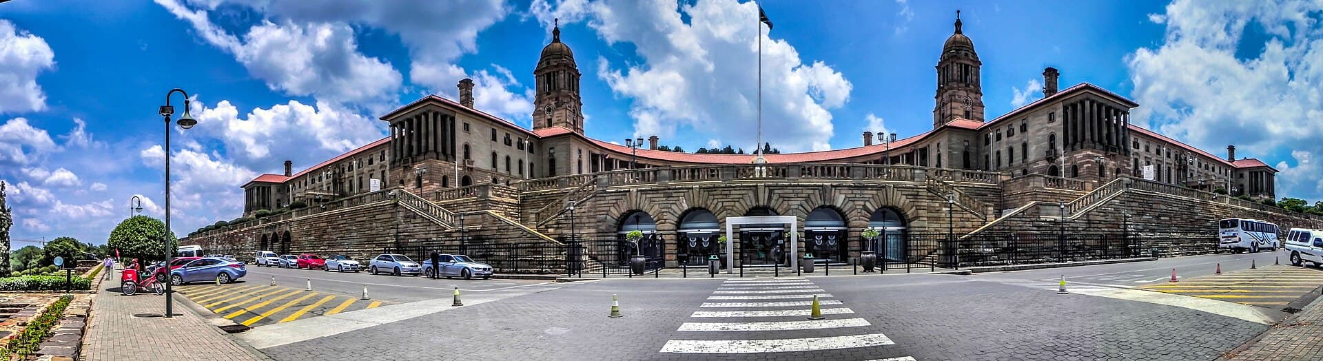 Monuments & VillesGauteng
Union Buildings
Le croissant de grès de Herbert Baker couronne une colline de Pretoria — le siège du gouvernement sud-africain où Mandela prêta serment, dont les jardins sont aujourd'hui un emblème de réconciliation inscrit à l'UNESCO.
Vérifié · 4 sources